Saturday, June 28, 2014

THE APPALACHIAN TRAIL ADVENTURE CONTINUES: DICK'S CREEK GAP, GA TO WINDING STAIR GAP, NC (PT 1)

SUNDAY, JUNE 1ST, 2014
      DAY 1:  DICK'S CREEK GAP, GA TO BLY GAP, NC

We could hardly wait to get started on our next A.T. adventure!  The ride from where we left our car to Dick's Creek Gap took only a few minutes and before we knew it, we were standing there, ready to embark on Day 1 of our 5 day trek.  The excitement in the air was palpable as we did our final gear check and cheered our departure along with several other hikers who arrived at the Gap to stage their own vehicle.  There was a mutual, "Let's do this," shared between us all!


And our trek began....


We had nine miles to go before reaching our destination for the night, Bly Gap, NC.  I went into this hike completely out of shape, having done very little other than a few knee exercises, so the task I was undertaking loomed larger than life ahead of me.  I chose to bring this fact to light now because I know there are so many people out there who use the excuse, "I'm out of shape so there's no way I could ever go for a hike in the mountains, especially not a multi-day hike." Some probably honestly believe this to be true.  To all of you I say, "Just do it!"  Don't get me wrong...being in good physical condition is definitely a plus when starting out on an undertaking of this nature...but it's not an absolute, do-or-die requirement.  The trail will whip you into shape.  Trust me on that one.  So...I was out of shape from having been relatively sedentary since my section hike last June, but our spirits were high and we managed to keep them that way for the most part.


The terrain that first day didn't let us down.  It was quite the challenge to get those muscles we rarely used back at home into the mode of carrying our own weight plus that of our packs for miles at a time.  We were met several times throughout the day will large trees that had fallen down across the trail, requiring us to climb up and somehow slip over the massive trunks....all without falling over on our faces.  Still, we were met with awe-inspiring natural beauty with every twist and turn of the trail


We've found that it works better for us if we stop for a hot lunch each day.  This not only fuels our bodies but also gives us a much-needed break from carrying our packs.  In hindsight, I think the one thing we don't do often enough is stop, take the packs off and just rest for maybe 10 or 15 minutes.  Most of our snacks are eaten during a quick stop where we take only enough time to consume our tasty treat before continuing on.  Yes, we do have a destination to reach each night, but I think breaks might be the key to reaching our goal while going a little easier on ourselves....at least until we get our "hiker legs" on.  Our lunch stop on Day 1 was at Plum Orchard Gap.


It might sound silly, but I take pictures of all the signs we come to along the trail.  I do this so I can remember exactly where we've tread.  When we came across these next signs, it began to feel a bit different.  We weren't far from the GA/NC state line, the crossing of which I'd been anticipating for a year.  It represented a milestone for me....I would be able to check one state off my list of 14.


We were still 3.1 miles from our stopping point for Day 1 and I'd be lying if I said we weren't feeling all that the mountains had already handed us but knowing that I'd be accomplishing a goal of mine kept that smile on my face.  Every now and then, we'd just stop and stand there, listening to the birds singing all around us.  There really is nothing like the peacefulness that I find all around me when I'm on the trail...it's one of the reasons I seek it out as often as I can.


Okay...drum roll please....wait for it.....wait for it.....


(Sorry this one's a little blurry)


The sense of accomplishment I felt as I stood, looking at the rather unremarkable GA/NC state line crossing sign is sort of indescribable for me.  In the scheme of the entire 2185 miles of the A.T., it was very small but for me, it was something I'd worked VERY hard for over my 3 section hikes and my Approach Trail hike.  I'd finally made it out of Georgia!  We joked about how the state of Georgia didn't hesitate to let the door hit us in the butt as we left the state behind.  I'd done Georgia.  Knowing that kept me smiling for a long time.

Once we crossed the state line, our campsite wasn't far.


With plenty of daylight left, Scott set out on the task of starting a fire while Debbie pitched our tents.  My job during all of this is to make us all a hot cup of coffee!


Now, I'm the planner of the group.  Scott and I both keep a close check on the weather in the area before we leave Florida.  So, I had looked at the 10 day forecast and seen the nighttime temps ranging in the mid to upper 50's.  It just didn't register so we were a bit unprepared for the gusty, chilly winds and the 56-59 degree temps each night at camp....

Yes...I know...I look beautiful!  


Again, a little blurry, but you get the idea...we were cold!

Hey...you do what you've got to do to stay warm!


We made use of whatever we had to try to at least block the wind.  We simply didn't think about the fact that we'd be arriving at camp each night, soaked with sweat, only to be met with wind and cooler temps.  Guess that's what happens when Floridians head for the mountains.  We learned a very valuable lesson...we'll never leave home again without some kind of jacket!  When all was said and done, however, we survived the elements on Day 1.  Something else we've learned is that no matter how tired you might feel, climbing into your tent super-early isn't usually the best option.  It doesn't take long for the exertion of the day to set in and that ground starts to feel very hard and uncomfortable.  I've found ways around most of the other issues the trail presents, but for me, no matter how "high-end" I go with my sleeping pad, I've yet to find a way to spend the night comfortably.  On a high note, when I left Dick's Creek Gap earlier that day, I did so figuring that I'd spend 4 sleepless nights in my tent, being terrified of all things that go bump in the night.  Not once did I experience that fear so I'm making progress!

We awoke the next morning and went through our typical morning ritual....coffee, breaking camp, and eating our oatmeal.  We knew we were going to be hit right off the bat with a formidable climb.  Standing Indian Mountain loomed ahead, still a day away, taking us up to 5498 feet in elevation, the highest we would reach on this hike. Leaving Bly Gap, we would be hanging in above 4000 feet in elevation for the remainder of our trek once we reached Courthouse Bald (4666 ft, up from 3840 ft) .  The sun was shining bright and the birds were singing loudly as we headed out of camp...almost as if they wanted to cheer us on as we walked head-on into our first climb of the day.  


We set our sights northbound....onward weary hikers!  Standing Indian awaits but we must first conquer Courthouse Bald and Yellow Mountain!


Friday, June 13, 2014

THE LESSON OF ALBERT MOUNTAIN

I recently completed a 40.2 mile section hike of the Appalachian Trail, starting at Dick's Creek, GA and finishing up at Winding Stair Gap, NC.  This was actually my third long distance section hike and, while each has provided me with its own unique challenges, this particular one forced me to face and work through one of my deep-seated fears:  my fear of heights, the "edges" that come with heights of any kind, and my own lack of confidence in my physical abilities (very little balance, knee weakness, ect).  As our climb of Albert Mountain began, the fact that we would come across a bypass route stood looming in the back of my mind.  I've never opted for the "easy route" during any of my section hikes, but all the doom and gloom I'd been hearing about what a difficult climb this particular mountain was going to present us with made me start to actually consider using the bypass rather than climbing the direct route.  When the time came, however, up we went.  The trail held true to its mere 18-24 inch width, adding slick rocks, mud, and tree routes to the mixture of obstacles it tossed at us.  Add to this the fact that when the vegetation growing along the right side of the trail offered a glimpse of what lay below, what I saw was nothing.  We were, in fact, skirting the edge of the cliffs.  One wrong move and all could go very, very wrong.  Still, I managed to make my way slowly up that treacherous mountainside by keeping my eyes focused on the trail and what was ahead of me rather than looking off to my right.  There were a couple of places where the dense vegetation gave way to some breath-taking views:


There were also times where we were almost plastered against the side of the mountain as we made our way down the narrow trail:


As we moved ahead, the trail met us with lots of rocks, roots, and stairs that had been placed to assist with the climb, which were challenging enough on my tired legs but the final push to the summit opened up to an almost 90 degree grade that required us to pretty much climb up on our hands and knees, taking great care not to straighten our posture which would have ensured that the weight of our packs would have easily pulled us over backwards.  At one point, my brother moved in behind me because I could feel my uncertainty in my own ability to complete the climb threatening to take over.  With the top in sight, I was suddenly overcome by it all.  I remember saying, "Not only is this hard for me but I'm scared," and panic took over.  I began to do what I now laughingly call my Howler Monkey imitation and could feel myself starting to hyperventilate.  My sister had already reached the top but she later told me that she'd never seen such a look of sheer terror on anyone's face and she knew that I was in trouble so she quickly made her way back down, took my arm, and with the help of my brother behind me, I made it up to a point where I was able to stand securely and just let it all out.  There was nothing I could do to stop this lovely display of emotion.  It just had to run its course...but thanks to all the positive words and encouragement from my sister, brother and our two hiking companions, Mr. Wonderful and Morning Glory, I regained my composure and finally made it to the summit.

Morning Glory and Mr. Wonderful


We all reached the summit of Albert Mountain feeling more energized than we had at any other time during our hike.  I suppose it was more of an adrenaline rush but whatever it was, we all felt it.  We slowly climbed the fire tower, and the panoramic views we were met with made the whole thing worth it:


I'm sure that if you asked many of the hikers who have made this climb before me, they would probably say that it was quite the challenge but for me, it was so much more than that.  It certainly wasn't one of my proudest moments.  I'm not use to putting my emotions on such public display.  But the whole experience taught me a couple of very valuable lessons that I hope to carry with me into the future:  I CAN do so much more than I give myself credit for; I CAN push through my fears and challenge myself like I never thought I could; and there is NOTHING wrong with needing a little help sometimes.  My brother, sister and I often joke about how the Keith's aren't quitters and this mountain helped me prove that to myself.  I was terrified, more so than I can ever remember being, but I didn't freeze up.  I didn't take the "easy route."  I made it to the top, with a little help from my family.  What lessons could be more valuable than those?

Happy hiking everyone!

Monday, May 26, 2014

WHERE THE TRAIL TAKES ME...


My pack is loaded. I've taken it all out and double-checked it several times just to make sure I haven't forgotten anything important. Now...the countdown to June 1st has officially begun and I'll spend the next few days contemplating my upcoming 40 mile hike on the A.T.: Will the weather cooperate? We've been rained on for at least most of one day every time we've gone out. Will we come across another bear on the trail, as he/she sits calmly, tasting blackberries. What sounds will fill what's suppose to be the silence of the night? I've learned that the woods is a very loud place at night. Will we share our camp each night with others? Will there be any equipment malfunctions? Any falls this time? At the rate I'm going, how many years will it take me to finish? All of these rather mundane things will go through my mind this week. But they say it's not how far you go but the journey that counts...and I believe this to be true. From the first time I laid eyes on the A.T. sign at the Amicalola Falls visitor center, I knew that walking the A.T. was something I had to do, no matter how long it takes me. It's what I learn about myself that keeps me going back....how I am forced to face some of my fears and push through the pain even when that voice in my head tries to tell me to quit. When I come out of those woods at Winding Stair Gap, NC the sense of accomplishment will be like nothing I experience in anything else I do. I find I feel more at home out on the trail than I do sitting here in my apartment...and to quote my sister as she stood, looking out across the view from the summit of Blood Mountain during our first day hike up...."It just doesn't get any better than this!" So yes...I'm looking forward to "getting back to nature," for it is there that I find my true self hiding behind the conventions put on me by the grind of daily life....and when I come out of the woods I'll be dirty, exhausted, sore and very smelly but I'll be smiling with a sense of pride and joy rivaled by nothing else I do!

Looking out from Powell Mountain

Saturday, March 29, 2014

TORREYA STATE PARK


Our quest to discover and explore new places took my brother, his wife and myself up into the panhandle of our state to one of Florida's most scenic places, Torreya State Park.  I've been spoken often of Florida's flat topography so I will be the first to say that the park's location upon the high bluffs overlooking the Apalachicola River was a pleasant surprise!  The park was named after an extremely rare, endangered species of conifer trees known as Torreya taxifolia after the 19th century botanist, John Torrey.  This conifer grows almost exclusively within the park's borders and is magnificent to look at.


This photo doesn't do the trees justice as we were in awe to come across them growing along one of the many hiking trail within the park, seeing them soar to amazing heights.

The park is also home to the Gregory House, which was originally part of a prosperous plantation before the Civil War, standing across the river from the park at Ocheesee Landing.  In 1935, the CCC moved the home to it's current location and restored it for use as a possible small hotel.  Currently, the park staff offers tours of the home at various times of day.


The view from a bench behind the Gregory House of the Apalachicola River

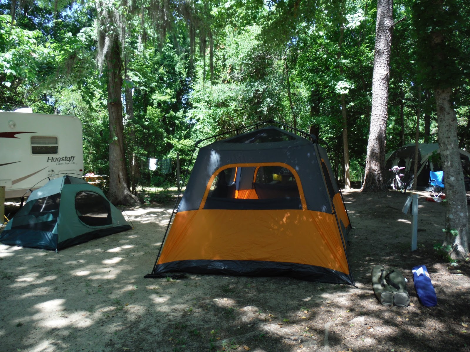
The park offers 30 shaded campsites with water and electric hookup and can accommodate RV's up to 60 feet in length.  Restrooms with showers are located within the park's facilities.  Each site has a picnic table and fire pit with a grill.  Here was our site:


I have to admit that when we pulled in and saw how close we were going to be to our neighbors (we had someone on each side of us), we were all a bit skeptical and not sure we were going to enjoy our weekend.  Our first thought was the noise at night, but by nightfall, most of our fellow campers were doing just what we were doing....


...enjoying dinner and simply hanging out around the campfire.  I'd say by 10:30 or 11pm at the latest, the park went silent and the nights were peaceful.  I'll add that on the weekend we were there, over Memorial Day, there was a beautiful full moon which really made my nights.  I remember waking at some point in the wee hours of the morning to find the moon up high, shining brightly right behind my tent, allowing me to lay there in my bag and just look up at the beautiful night sky.  That was probably the highlight of my weekend honestly.  It was breathtaking!

As for the majority of the Florida terrain being flat, we were excited to finally come across an area that provided us with a challenge while hiking.  Torreya State Park offers a wide variety of hiking trails so there's something for everyone.  Us being us, this is the one we sought out:


From our campsite, all the way around the trail and back to where we began measured roughly 10 miles and saw elevation changes of about 250 feet.  Now, that's minimal compared to what the mountains and the Appalachian Trail tossed at us, but for Florida, we'll gladly take it!  We wandered through a maze of changing scenery:


Overall, I would rate our time at Torreya State park as exceptional and hope to return there again in the future.  The diversity found within its boundaries is sure to provide an amazing time for all, regardless of what you seek from your time there....physical challenges, a bit of state history, or just some peace of mind one can only find out in the woods.  Happy hiking everyone!


Sunday, August 18, 2013

BEACH CAMPING OUT ON ANCLOTE KEY


Beach camping was something I had never done, so when my brother suggested we load up his boat and head out to give it a try, I said, "Let's do it!"  It was an early November day when we were all finally able to coordinate our schedules, load up and go.  Prior to our departure, Scott did attempt to call the ranger to let him know we were going to be out there overnight.  He was unable to actually speak with the man but he did leave a message so I'd suggest doing the same before your chosen camping date.

We loaded up my brother's truck and headed for the boat ramp up at Anclote River Park.  There are actually two locations almost side by side.  We passed the actual park entrance and used the second area to park the truck overnight and launch the boat.  A couple words to the wise are needed here I think:

1. There are only a couple of boat launch slips and competition is ferocious!  I've personally witnessed full grown adults getting into pretty much knock-down-drag-out fights over who gets the slip next!  My advice is avoid the early mornings and mid-afternoons if you can to help alleviate some of the congestion at the slips.
2. The current is exceptionally strong surrounding the boat launch area so extra caution is needed to prevent damage to your boat, particularly upon your return to the slip. 

That being said, this launch area is nice, being equipped with restrooms, often times a lunch cart of some type, and a roped-off area where swimming is allowed.


Captain Scott Keith, Tampa Bay Inshore Charters

 
The ride through the channel to Anclote Key Island is relatively short but can be quite the challenge depending on the amount of boat traffic you encounter.  Once you begin to approach the island, you're free to maneuver outside the channel area to reach your destination.  My brother is also an inshore charter captain (check out his Facebook Page at https://www.facebook.com/pages/Tampa-Bay-Inshore-Charters/233467050077386  ) so he had taken the time to calculate the tides so there would be little chance of beaching his boat (should that happen, all you've got to do is wait till the next high tide rolls in) and we were able to nose the boat up close enough for us to unload the cargo, wading in knee-deep water. 

Securing the boat for the night

We had the whole beach to ourselves!


My "room with a view" for the night

Always have to have a campfire!

Once we had the gear unloaded and the boat secured, we set up our camp.  I have to say that, while we could not feel the humidity in the air at that time of day, our tents almost immediately became wet from it so we had to put up our rainflys.  On our next trip, we will do this at the time we set up the tents to hopefully help keep them dry.  Also of note is that there is one composting toilet on the island but it's a walk away and you'll most likely have to wade tidal pools to reach it.  Being backpackers, we are always prepared for this so it wasn't an issue for us (just always remember the pack in pack out rule of thumb and don't leave your trash/other items behind). 


Once we were all settled in, we took a nice, long walk on the beach just as the sun was setting.  It was probably one of the most peaceful things I've done in a long time.


We enjoyed a tasty dinner of hot dogs cooked over our open fire, chips and then later, smores.  In spite of being so relaxed and tired, we opted to stay up until the moon came up because it was promising to be amazing.  I tried to take pictures of it but they didn't turn out but trust me....it was absolutely beautiful!  I don't think I've ever seen so many stars!

We woke the next morning fairly deep in a fog...to the point of our hair dripping wet as if we'd just stepped out of the shower and actual puddles forming in our chairs.  While it contributed to a glorious sunrise, it burnt off fairly quickly and we dried out...


The boat stayed put overnight but as you can see, it appears much closer to the shoreline that it did when we unloaded it the night before.  Scott had taken this into account, planning our departure from the island to coordinate with the next high tide.


In retrospect, the only thing I would have done differently is not set up my tent where I did.  If you look in this picture, you can see the dead sea grass....that's how close the water from the high tide the night before came to my humble abode.  At one point during the night, I sat up and unzipped the window to take a look and it appeared as if my tent was floating on top of the water.  Granted, listening the to water lapping the sand so close to my tent was relaxing in a way, the worry that I'd soon feel the wetness invading my sleeping quarters was not.  Next time I'll pitch my tent a bit further back!

I guess if I had to list one complaint with this beach camping experience, it would be that it simply wasn't long enough!  We're planning to return once the weather is suitable and when we do, we'll either go out for two nights or get a much earlier start!  Two nights would require us to make two trips mainly because there is no firewood out on the island so you've got to transport your own.  That added weight will make two trips necessary but the good news is it's not that far out and won't take too long!  I often sit here at night, thinking back to this experience...remembering how relaxing it was, how beautiful it was to look across the channel to the other island and see campfires burning or to watch them launch those paper bag candle things (sorry...don't know what they're actually called).  If you ever have the chance to spend the night out on this beautiful island, please don't let it pass you by.  You'll be so glad you went!!!

One last look down the beach from our camp!

Friday, August 2, 2013

APPALACHIAN TRAIL CONSERVANCY'S 2103 MEMBERSHIP DRIVE!!!

Happy Friday to my followers and anyone else who might come across my blog!!!

It's time for the ATC's 2013 membership drive so here I am, shamelessly promoting it!!!  Please take a moment to click on the link below for more info on this fun-filled event!  I will be volunteering here in Tampa but this drive goes to many different cities and one of them might be yours (or close to you)!

http://appalachiantrail.org/promo/2013-membership-drive---journey-of-2000-miles/overview


I can't wait to see the new movie, 'Appalachian Impressions,' and hear what others have to say about the A.T.  Having hiked roughly 80 miles of the Georgia section (including the 8.5 mile Approach Trail), I love talking about being out on the trail!!!

So...join us for a fun evening and upon checkout, enter the following promo code:

AT2014

to receive $5.00 off the price of your ticket!  You'll be glad you took the time for this!!